
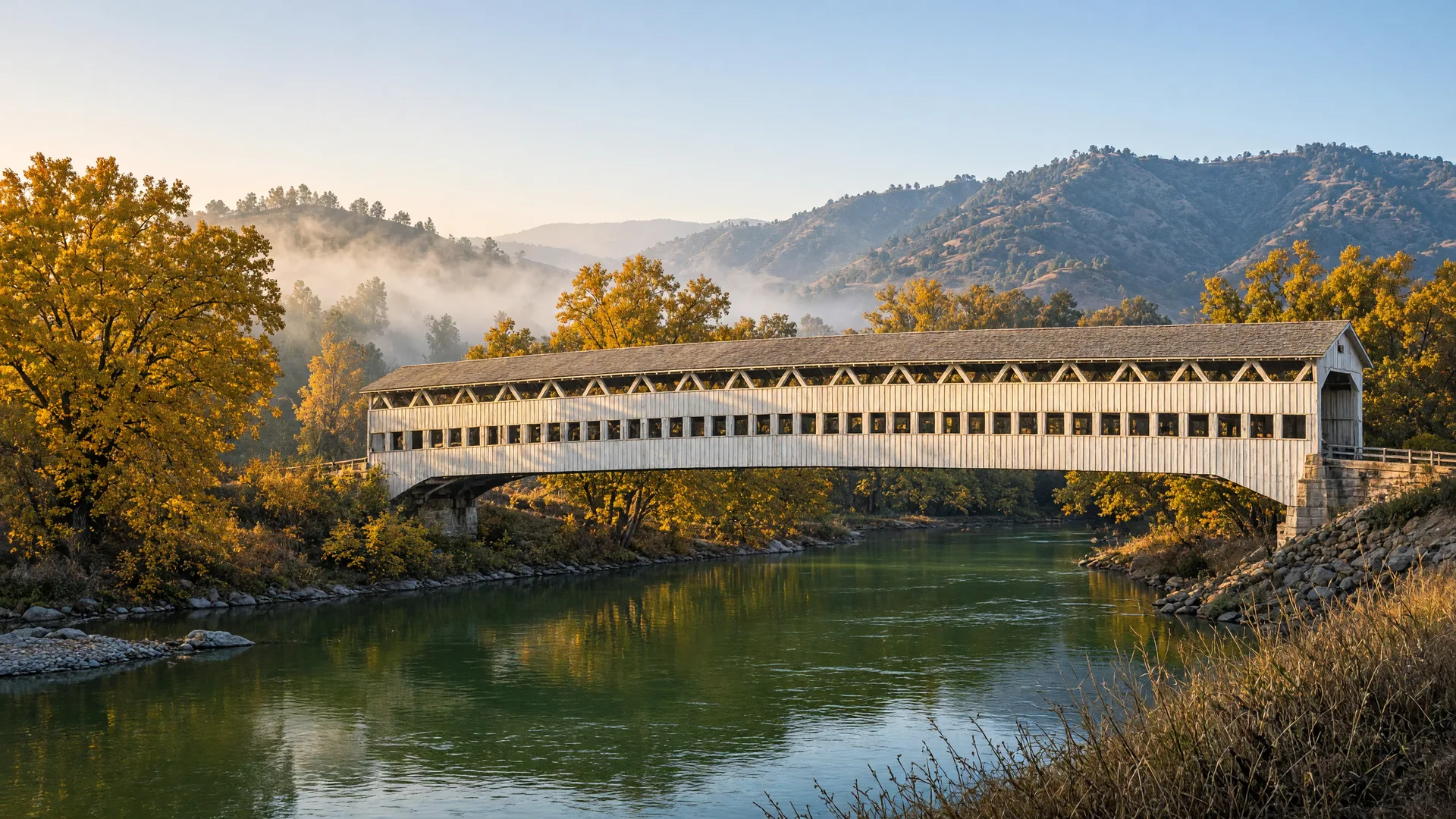
For the best hiking trails near Turlock this week, the pick is Knights Ferry Recreation Area, a U.S. Army Corps of Engineers park on the lower Stanislaus River with the historic 1863 covered bridge. Late November is an ideal window for it: the canyon stays low and open, the mornings are cool, and the sycamores and cottonwoods along the river are still showing autumn color.
Knights Ferry sits on the Stanislaus River about 12 miles east of Oakdale, at the edge of the Sierra foothills, roughly 30 miles northeast of Turlock. It is one of the Stanislaus River Parks operated by the U.S. Army Corps of Engineers Sacramento District, with day-use areas on both sides of the river around the historic mill town of Knights Ferry. The drive is an easy one from Livingston and a reasonable day trip from Merced, and the park makes a natural Thanksgiving-week outing because the walking is flat, the picnic areas are set up, and the river canyon stays open through the winter. If you want the wider nature calendar, this week's Seasonal Nature Report follows the fall color down to the valley floor, with the cranes at their November peak at the refuge and the chinook salmon run still at its height at Snelling.
Best Hiking Trails Near Turlock: Knights Ferry Recreation Area
What makes Knights Ferry worth the drive is the combination of a genuinely easy riverside trail and a piece of California history. The covered bridge, built around 1863 and about 330 feet long, was long considered the longest covered bridge west of the Mississippi; today it is closed to foot traffic for restoration, so you view it from the banks, which are a photography stop in their own right in the low morning and late-afternoon light. The river itself is the show: green water rolling through an oak and sycamore canyon, with the old mill buildings, the historic district, and quiet banks for fishing and birdwatching. On a late-November morning the canyon is quiet, the light is low and golden, and a walk along the river is genuinely comfortable before the winter chill deepens.
Trail Details: The Stanislaus River Loop
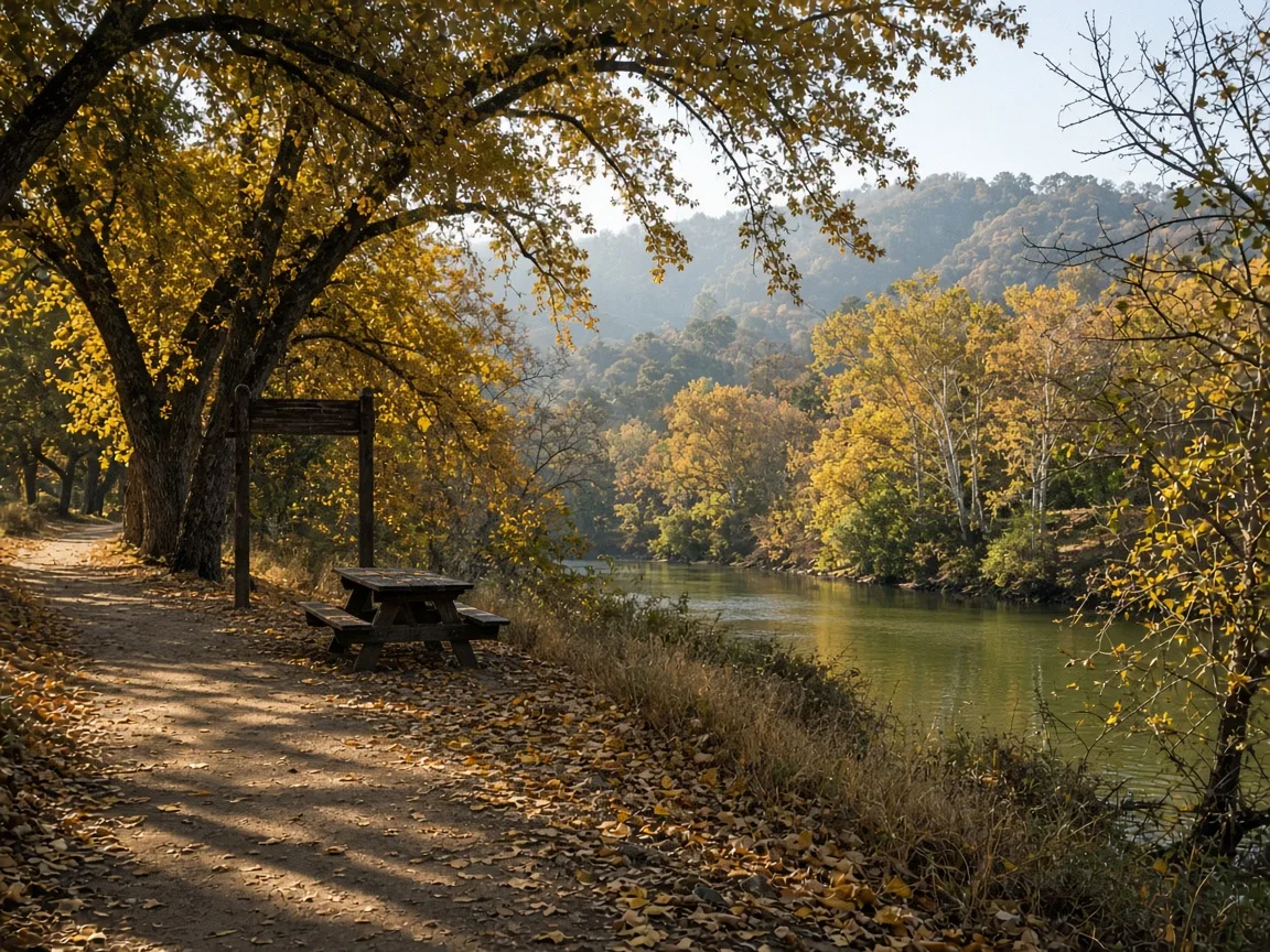
The Stanislaus River Loop from Knights Ferry is an easy, mostly flat loop of about 1.5 miles, per AllTrails, along the river through the trees, with most walkers finishing in about 40 minutes at a walking pace. A longer out-and-back option continues along the river for anyone who wants more distance. The park itself publishes no separate official trail length or difficulty, so the AllTrails figure is the reference. The route is a loop, so there is no turnaround to plan around beyond your own pace, and the surface is packed dirt and gravel with no significant elevation gain. After a storm the trail can hold muddy patches and the river runs fast and high, so check conditions before heading out and keep well back from the water's edge.
Amenities
The park is set up for day use: picnic tables and barbecue pits are scattered through the grounds, and there are restrooms, drinking-water fountains, historic exhibits in the old mill buildings, and an information and visitor center that posts current conditions. Dogs are allowed on leash. There is no developed campground at the main day-use area, so plan a day trip: a picnic lunch, a riverside walk, and a stop at the bridge viewpoint. For the wider water calendar across the county, this week's Lake & Water Activities guide covers the lakes and river access from Lake Yosemite to Lake McSwain and Lake McClure.
Parking, Fee, and Hours
Day use costs $10 per vehicle, and the park is open daily from sunrise to sunset. Parking is included in the day-use fee, with lots on both the north and south sides of the river; the main lots sit beside the fee machines, and the loop trailhead is a short walk from either side. There is no separate admission gate, so bring a payment method for the fee machine before settling in for the day. The fee applies equally to all visitors.
Getting There From Merced County
From Turlock, take Highway 99 north to Oakdale, about 30 minutes, then Highway 108/120 east about 12 to 13 miles to Knights Ferry; the drive totals about 32 miles and roughly 50 minutes. From Livingston, plan about 35 to 40 miles and roughly an hour via the same route. From Merced, count on about an hour and a quarter north on Highway 99 and east on Highway 108/120, and from Atwater slightly less than that. The park address is 17968 Covered Bridge Road, Oakdale.
Best Time to Go
In late November, go mid-morning. The early fog typically lifts by late morning, the sun warms the canyon through the middle of the day, and the low golden light on the river and the bridge is at its best in the first hours of sunshine. Weekday mornings are the quietest, which makes the picnic areas and the bridge viewpoint more private. The park is low-elevation and open year-round, so it stays accessible when foothill trails are cold or wet; after a storm, expect muddy stretches on the loop and a higher, faster river, and check the Corps' current conditions before the drive. Plan to wrap up while there is still daylight, since the days are short this time of year.
Map and Official Links
The official U.S. Army Corps of Engineers page for the Stanislaus River Parks posts park status, fees, and current notices for Knights Ferry, and the Google Maps listing for Knights Ferry Recreation Area provides turn-by-turn directions to the Covered Bridge Road entrance. Both open in a new tab.
Past Picks
Week of November 12: Applegate Park, the free 32-acre city park in Merced with a duck lagoon, playgrounds, picnic shelters, and the Applegate Park Zoo. Week of November 5: Stockton Creek Preserve, the free foothill nature preserve in Mariposa with a moderate 3.3-mile oak woodland loop and two trailheads on the edge of town. Week of October 29: Merced River Trail at Briceburg, the free foothill hike on the old Yosemite Valley Railroad grade along the Wild and Scenic Merced River east of Mariposa. Week of October 22: McConnell State Recreation Area, the 74-acre Merced River park near Livingston with camping, fishing, and easy riverside walks. Week of October 15: Lake Yosemite Regional Park, the day-use lake park in Merced with an easy 3.5-mile lakeside loop and $10 day use. Week of October 8: Merced National Wildlife Refuge, the free refuge about 12 miles southwest of Merced with a 5-mile auto tour, two easy 1-mile walking loops, and sandhill cranes arriving through the fall. Each week's pick is archived here, so you can build a year-round list of parks and trails across Merced County and the nearby Sierra foothills. These public lands are open to everyone, and Monica offers equal service to all.
Enjoy the outdoors, Turlock. And when you are ready to talk about your home, Monica is here: schedule a free consultation with Monica Franks, The Seller's Agent, and learn more about Monica's approach on her about page.
Frequently Asked Questions About Parks and Trails Near Merced
What are the best parks and trails near Merced?
Knights Ferry Recreation Area is this week's pick for an easy, low-elevation riverside walk with the historic covered bridge. Closer to Merced itself, Lake Yosemite Regional Park has an easy 3.5-mile lakeside loop with $10 day use, McConnell State Recreation Area on the Merced River near Livingston has camping and easy riverside walks, and Stockton Creek Preserve in Mariposa offers a moderate 3.3-mile oak woodland loop.
How long and how difficult is the trail at Knights Ferry?
AllTrails lists the Stanislaus River Loop from Knights Ferry at about 1.5 miles, easy and mostly flat along the river, with most walkers finishing in about 40 minutes. A longer out-and-back option continues along the river for anyone who wants more distance. The park itself publishes no separate official trail length or difficulty, so the AllTrails figure is the reference.
Is the Knights Ferry Covered Bridge open to walk across?
No. The bridge has been closed and fenced since December 2022 for restoration work, and U.S. Army Corps of Engineers updates as of late 2026 still list it closed to pedestrians, with reopening expected to take several more years pending funding. You can view the bridge from the riverbanks and the adjacent grounds, but you cannot walk across it.
What is the day-use fee and what hours is Knights Ferry open?
Day use costs $10 per vehicle, and the park is open daily from sunrise to sunset. Parking is included in the day-use fee, with lots on both the north and south sides of the river. The fee applies equally to all visitors, with no separate admission gate.
Are dogs allowed at Knights Ferry Recreation Area?
Yes, dogs are allowed and must stay on a leash. The park is a popular stop for a riverside picnic and walk with a dog, and the restrooms and drinking fountains make it an easy outing.
How far is Knights Ferry from Turlock?
About 32 miles, roughly a 50-minute drive: take Highway 99 north to Oakdale, then Highway 108/120 east about 12 to 13 miles to the park. From Livingston allow about an hour, and from Merced roughly an hour and a quarter via the same route.

The Seller's Agent. Monica combines deep Merced County market knowledge with a polished, confident approach that gets results for home sellers across the Central Valley. Serving Merced, Atwater, McSwain, Livingston, Turlock, Winton, Chowchilla, Catheys Valley, and Mariposa.
The Seller's Agent. Who You Choose Matters.
Enjoy the outdoors, Merced. And when you are ready to talk about your home, Monica offers a free, no-obligation consultation to discuss your goals and what your property could achieve in today's market. Call (209) 345-3836 or use the form below.
Add Monica Franks as a Preferred Source on Google to see more of my content in AI Mode and AI Overviews.
Add as Preferred Source