
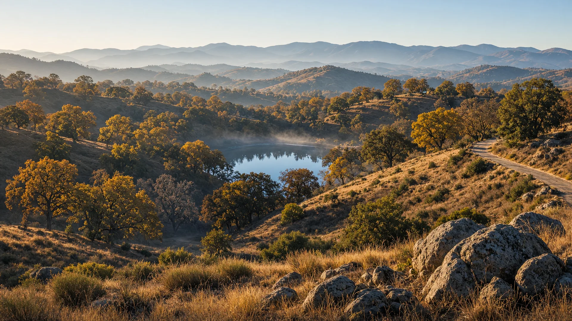
For the best hiking trails near Mariposa this week, the pick is Stockton Creek Preserve, a free foothill nature preserve on the edge of town that protects the watershed around Stockton Creek Reservoir. Early November is a sweet spot for it: the oaks are gold, the air is cool, and the low-elevation trails usually stay open and snow-free through the coldest months.
Stockton Creek Preserve sits on the west side of Mariposa, about 35 miles northeast of Merced via Highway 140 through Catheys Valley. The Mariposa Public Utility District acquired the first 410 acres in 2011 and added 360 more acres in 2019, working with the Sierra Foothill Conservancy, and the preserve now holds more than 4 miles of trails around the town's primary domestic water reservoir. It is free to visit, open during daylight hours, and built for easy access right from town, which makes it the most convenient foothill hike in the county. If you missed the wider nature calendar, this week's Seasonal Nature Report covers the fall color at its peak in the Yosemite foothills and the county's November wildlife.
Best Hiking Trails Near Mariposa: Stockton Creek Preserve
What makes Stockton Creek Preserve worth a November visit is the combination of shade, views, and convenience. The trails climb gently through valley oak, blue oak, and black oak woodland with granite outcrops along the way, and the early-November golden light turns the hillsides amber in the morning and at dusk. From the upper sections of the loop you look out over the reservoir and across the rolling Sierra foothills toward the higher country, and the preserve is quiet enough on weekday mornings that you may hear nothing but birds. It is managed as public drinking-water watershed land, so the experience stays genuinely wild despite sitting minutes from downtown Mariposa.
Trail Details: The Stockton Creek Preserve Loop
The Stockton Creek Preserve Loop is a roughly 3.3-mile loop rated moderate, with about 540 feet of total elevation gain per AllTrails, and most hikers finish it in 1.5 to 2 hours at a steady pace. The Yosemite/Mariposa County tourism guide publishes a similar 3.2-mile route with 538 feet of gain, so expect a rolling up-and-down loop, not a flat path; a shorter 2.8-mile route and a longer 3.8-mile route are also documented for walkers who want to adjust the distance. The route is a loop, so there is no turnaround to plan around, and the preserve is open to hikers and mountain bikers. Some sections pass poison oak along the trail edges, so wear long pants or watch your footing, and on warm afternoons keep an eye out for rattlesnakes.
Amenities
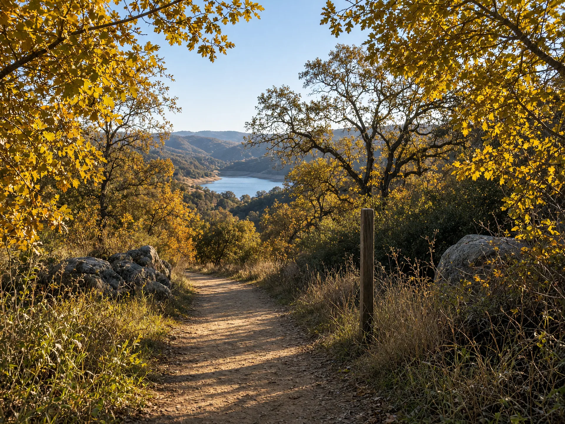
The preserve is kept intentionally light on development: two trailhead kiosks with maps and trail information, a gravel parking turnout, and the trail network itself. There are no restrooms, drinking fountains, picnic tables, or trash service at the trailheads, so pack water, snacks, and a bag for your own trash. Dogs are welcome at Stockton Creek Preserve, an uncommon allowance among Sierra Foothill Conservancy preserves, though the standard foothill cautions apply: poison oak near the trail margins and, on warm days, rattlesnakes. Because the reservoir is Mariposa's protected drinking-water source, the fenced reservoir area is closed to the public from 3 p.m. to 8 a.m., so keep all visits during daylight hours and stay on the marked trails.
Parking and Getting There
Parking is free at both trailheads. The main trailhead sits off Highway 140 on Slaughterhouse Road, about a mile north of downtown Mariposa, with a gravel turnout parking area and a trailhead kiosk. The second is the Trabucco Street trailhead on the west side of town: park near the high school football field and walk past the locked gate by the water treatment facility, where a kiosk marks the start of the trails. From Merced or Catheys Valley, take Highway 140 east and follow the signs into Mariposa; the drive from Merced is roughly 50 to 60 minutes, and from Catheys Valley about half an hour. The Slaughterhouse Road lot is the easier option for first-time visitors and usually has space on weekday mornings.
Best Time to Go
In November, go in the morning. The air is cool, the light comes in low and golden through the oaks, and the trail stays mostly shaded on the north-facing sections. Weekday mornings are the quietest, with the reservoir glassy and the parking easy. The preserve is usable year-round at about 2,000 feet of elevation, and November frosts burn off by late morning; after a storm the trail can turn slick and muddy on the steeper pitches, so check the forecast and the Mariposa Public Utility District page for any notices before the drive. Mountain bikers will find the loop drier and faster in the late morning, and afternoon visitors should start early enough to finish well before dusk, since the reservoir area closes at 3 p.m. and the trails are best hiked in full daylight.
Map and Official Links
The official Mariposa Public Utility District page for Stockton Creek Preserve posts trail information, the trailhead locations, and current notices. For turn-by-turn directions, use the Google Maps listing for Stockton Creek Preserve. Both open in a new tab.
Past Picks
Week of October 29: Merced River Trail at Briceburg, the free foothill hike on the old Yosemite Valley Railroad grade along the Wild and Scenic Merced River east of Mariposa, with fall color at its peak and published trail length and difficulty. Week of October 22: McConnell State Recreation Area, the 74-acre Merced River park near Livingston with camping, fishing, and easy riverside walks. Week of October 15: Lake Yosemite Regional Park, the day-use lake park in Merced with an easy 3.5-mile lakeside loop and $10 day use. Week of October 8: Merced National Wildlife Refuge, the free refuge about 12 miles southwest of Merced with a 5-mile auto tour, two easy 1-mile walking loops, and sandhill cranes arriving through the fall. Each week's pick is archived here, so you can build a year-round list of parks and trails across Merced County and the nearby Sierra foothills. These public lands are open to everyone, and Monica offers equal service to all.
Enjoy the outdoors, Mariposa. And when you are ready to talk about your home, Monica is here: schedule a free consultation with Monica Franks, The Seller's Agent, and learn more about Monica's approach on her about page.
Frequently Asked Questions About Parks and Trails Near Merced
What are the best parks and trails near Merced?
Stockton Creek Preserve in Mariposa is the top pick for a free foothill walk this week: a moderate 3.3-mile loop through oak woodland with two trailheads on the edge of town. Closer to the valley floor, Lake Yosemite Regional Park offers an easy 3.5-mile lakeside loop with $10 day use, McConnell State Recreation Area on the Merced River near Livingston has camping and easy riverside walks, and Merced National Wildlife Refuge, this series' first pick, offers a free 5-mile auto tour and two 1-mile walking loops.
How long and how difficult is the Stockton Creek Preserve Loop?
AllTrails lists the loop at about 3.3 miles with roughly 540 feet of elevation gain, rated moderate, with most hikers finishing in 1.5 to 2 hours. The Yosemite/Mariposa County tourism guide publishes a similar 3.2-mile route with 538 feet of gain, so expect a rolling, moderately graded loop rather than a flat stroll.
Is Stockton Creek Preserve free to visit?
Yes. The trails are open to the public free of charge, and parking at both trailheads is free. The Mariposa Public Utility District manages the preserve with the Sierra Foothill Conservancy, and there is no entrance gate or day-use fee, so plan to hike during daylight hours.
Are dogs allowed at Stockton Creek Preserve?
Yes. Stockton Creek Preserve is dog-friendly, an exception among Sierra Foothill Conservancy preserves, which usually allow only service dogs. Watch for poison oak along the trail margins and, on warm days, rattlesnakes, and keep pets close on the narrow sections.
Where do you park for Stockton Creek Preserve?
There are two trailheads. The Slaughterhouse Road trailhead sits off Highway 140 about a mile north of downtown Mariposa, with a gravel turnout parking area. The Trabucco Street trailhead is on the west side of town near the high school football field: park there and walk past the locked gate by the water treatment facility beside the preserve.
How far is Stockton Creek Preserve from Merced?
The preserve is about 35 miles from Merced via Highway 140, roughly a 50 to 60 minute drive through Catheys Valley. From downtown Mariposa the trailheads are just a few minutes away, which makes the loop an easy outing when you are already in town.

The Seller's Agent. Monica combines deep Merced County market knowledge with a polished, confident approach that gets results for home sellers across the Central Valley. Serving Merced, Atwater, McSwain, Livingston, Turlock, Winton, Chowchilla, Catheys Valley, and Mariposa.
The Seller's Agent. Who You Choose Matters.
Enjoy the outdoors, Merced. And when you are ready to talk about your home, Monica offers a free, no-obligation consultation to discuss your goals and what your property could achieve in today's market. Call (209) 345-3836 or use the form below.
Add Monica Franks as a Preferred Source on Google to see more of my content in AI Mode and AI Overviews.
Add as Preferred Source