
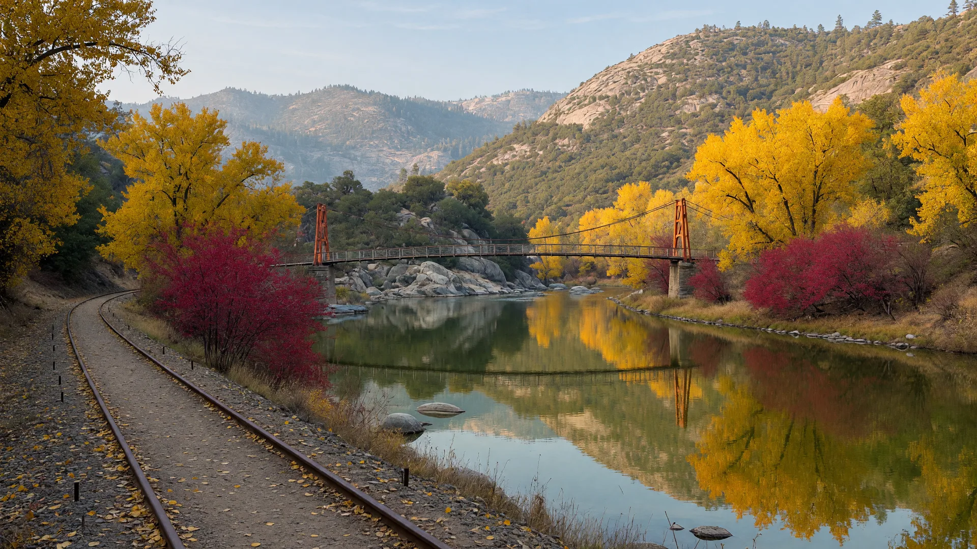
For parks near Merced this week, the pick is the Merced River Trail at Briceburg, a free foothill hike along the Wild and Scenic Merced River on the old Yosemite Valley Railroad grade. Late October is its best window of the year: the Highway 140 corridor is at full fall color right now, the river runs cool and clear, and the trail's low elevation stays mild while the high country gets its first snow.
The trail sits in the BLM Merced River Recreation Management Area in eastern Mariposa County, with the trailhead at the Briceburg Day Use Area on Highway 140 about 12 miles east of Mariposa. The drive from downtown Merced runs roughly 45 minutes up Highway 140 through Catheys Valley and Mariposa, so the trail works as a half-day trip from anywhere in the county. Day use is free all year, and the seasonal Briceburg Visitor Center is closed until next summer. If you missed the wider fall calendar, this week's Seasonal Nature Report covers the Highway 140 redbuds and cottonwoods at their peak and the season's first Sierra snow.
Parks Near Merced: This Week's Pick
What makes the Merced River Trail worth the drive in late October is the pairing of an easy, flat walk with genuine riverside fall color. The Yosemite Valley Railroad carried freight and passengers from Merced toward Yosemite until 1945, and the level grade it left behind now carries walkers, joggers, and cyclists along the river's north bank below the foothills. This week the western redbuds are gold and crimson along the canyon walls, the black cottonwoods glow yellow along the water, and the blue oaks show golden-orange on the slopes, with the color typically lingering here into early November because this is the lowest stretch of the entrance corridor. The river itself is the second act: still, green pools alternate with riffles, granite boulders line the bank, and on warm afternoons the fishing and river access keep the corridor busy without ever feeling crowded in fall.
Trail Details: The Merced River Trail
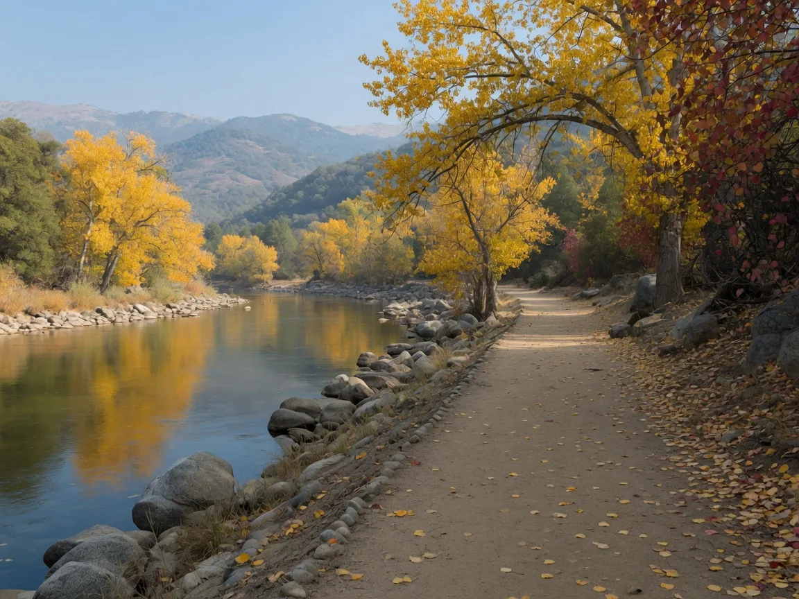
The Merced River Trail is a linear route on the old railroad grade, so the classic walk is an out-and-back rather than a loop. The BLM does not publish an official mileage, and third-party listings differ slightly: Rails-to-Trails TrailLink lists the open segment from the Briceburg day-use area to a gate just past Railroad Flat Campground at about 4.9 miles one way, while AllTrails lists the classic out-and-back at about 5.6 miles with roughly 220 to 310 feet of total elevation gain, rated easy to moderate. The grade is mostly flat, which makes any 2 to 6 mile portion of it an easy day. The trail continues past the gate toward Bagby for longer trips, and published hike reports describe excursions of 13 or more miles round trip. There is no drinking water on the trail, so carry your own, and note that parts of the river corridor are popular with kayakers and rafters, so expect river traffic near the put-in.
Amenities
The Briceburg Day Use Area, also called the Briceburg Put-in, is the starting point and the hub of the amenities: free parking, vault toilets with ADA access, picnic tables, and direct river access where paddlers put in on the Merced River. There is no entrance fee and no pass. A drinking-water point sits at the start of the Briceburg road, but the trail itself has no water, so fill up before you walk. The Briceburg Visitor Center is seasonal and closed through the fall and winter. Farther down the unpaved Briceburg River Road, the three BLM campgrounds, McCabe Flat, Willow Placer, and Railroad Flat, offer campsites with restrooms for about $20 per night, reservable on Recreation.gov. Fishing in the river requires a valid California fishing license, swimming is at your own risk with no lifeguards, and the popular free swimming hole at Cable Rock Day Use Site is about 1.4 miles downstream from the day-use area.
Parking and Getting There
Parking is free at the Briceburg Day Use Area lot just below Highway 140 at the Merced River crossing, with an accessible gravel lot and direct access to the trail. From Merced, take Highway 140 east through Catheys Valley and Mariposa; the Briceburg signs appear about 12 miles east of Mariposa, and the drive is roughly 45 to 50 minutes total. From Mariposa itself it is a short 20-minute hop, which makes the trail an easy morning stop on the way to Yosemite. The unpaved Briceburg River Road continues past the day-use area to the three campgrounds, with a gate just past Railroad Flat Campground that ends vehicle access; walkers continue past the gate on the trail. On peak fall-color weekends the day-use lot fills by mid-morning, so arrive early.
Best Time to Go
In late October, go in the morning. The foothill air is cool, the light is golden on the river, and the day-use lot is quiet on weekdays. Fall color along Highway 140 is at its peak this week and typically lingers into early November, so the next two weekends are the window for the strongest color. Because the trail sits at low elevation, roughly 1,000 to 1,300 feet along the river, it stays walkable through the winter with mild temperatures, and after rain the unpaved Briceburg River Road can be muddy, so check the BLM alerts page before a winter visit. For the wider water-season calendar across the county, this week's Lake & Water Activities guide covers the same river corridor's free swimming holes at Cable Rock, plus Lake Yosemite, Lake McSwain, Lake McClure, and Hensley Lake.
Map and Official Links
The official BLM page for the Merced River Recreation Management Area posts current trail conditions, closures, and alerts for the Briceburg area. For turn-by-turn directions, use the Google Maps listing for the Briceburg Day Use Area. Both open in a new tab. The BLM Mother Lode Field Office can be reached at (916) 941-3101.
Past Picks
Week of October 22: McConnell State Recreation Area, the 74-acre Merced River park near Livingston with camping, fishing, and easy riverside walks. Week of October 15: Lake Yosemite Regional Park, the day-use lake park in Merced with an easy 3.5-mile lakeside loop and $10 day use. Week of October 8: Merced National Wildlife Refuge, the free refuge about 12 miles southwest of Merced with a 5-mile auto tour, two easy 1-mile walking loops, and sandhill cranes arriving through the fall. Each week's pick is archived here, so you can build a year-round list of parks and trails across Merced County and the nearby Sierra foothills. These public lands are open to everyone, and Monica offers equal service to all.
Enjoy the outdoors, Merced. And when you are ready to talk about your home, Monica is here: schedule a free consultation with Monica Franks, The Seller's Agent, and learn more about Monica's approach on her about page.
Frequently Asked Questions About Parks and Trails Near Merced
What are the best parks and trails near Merced?
The Merced River Trail at Briceburg is this week's pick for a free foothill river hike on the old railroad grade east of Mariposa. For a lakeside loop, Lake Yosemite Regional Park in Merced has an easy 3.5-mile trail around the lake. For a Merced River camping park near Livingston, McConnell State Recreation Area offers easy riverside walking. For wildlife and easy walking, Merced National Wildlife Refuge offers a free 5-mile auto tour and two 1-mile walking loops on the west side of the county.
Is the Merced River Trail at Briceburg free to hike?
Yes. Day use at the Briceburg area, including the trail, the river access, and the picnic tables, is free year-round with no entrance fee and no pass. The three BLM campgrounds along the Briceburg River Road, McCabe Flat, Willow Placer, and Railroad Flat, charge a camping fee of about $20 per night and are reservable on Recreation.gov.
How long is the Merced River Trail at Briceburg?
The BLM does not publish an official mileage, and third-party listings differ slightly. Rails-to-Trails TrailLink lists the open segment from the Briceburg day-use area to a gate just past Railroad Flat Campground at about 4.9 miles one way, and AllTrails lists the classic out-and-back at about 5.6 miles with roughly 220 to 310 feet of total elevation gain. Published hike reports describe longer excursions toward Bagby of 13 or more miles round trip.
Is the Merced River Trail at Briceburg hard?
No. The trail follows a mostly flat railroad grade with modest elevation gain, which is why third-party services rate the classic out-and-back easy to moderate. It is a linear, out-and-back route rather than a loop, and most walkers tackle a 2 to 6 mile portion of it and turn around. There is no water on the trail, so carry your own.
Is the Briceburg visitor center open?
The Briceburg Visitor Center is seasonal, open roughly Memorial Day weekend through Labor Day, so it is closed through the fall and winter until next summer. Day use, the trail, and the river access stay open year-round with no entrance fee. Check the BLM Merced River Recreation Management Area page for current alerts before you go.
Can you swim at Briceburg on the Merced River?
Yes. Cable Rock Day Use Site, about 1.4 miles downstream on the old Yosemite road, is the area's most popular swimming stop, with a river beach and no fee. There are no lifeguards, so swimming is at your own risk; check the current river flow before getting in, and note the BLM safety warning at Cable Rock, where the beach sits above rapids.

The Seller's Agent. Monica combines deep Merced County market knowledge with a polished, confident approach that gets results for home sellers across the Central Valley. Serving Merced, Atwater, McSwain, Livingston, Turlock, Winton, Chowchilla, Catheys Valley, and Mariposa.
The Seller's Agent. Who You Choose Matters.
Enjoy the outdoors, Merced. And when you are ready to talk about your home, Monica offers a free, no-obligation consultation to discuss your goals and what your property could achieve in today's market. Call (209) 345-3836 or use the form below.
Add Monica Franks as a Preferred Source on Google to see more of my content in AI Mode and AI Overviews.
Add as Preferred Source