
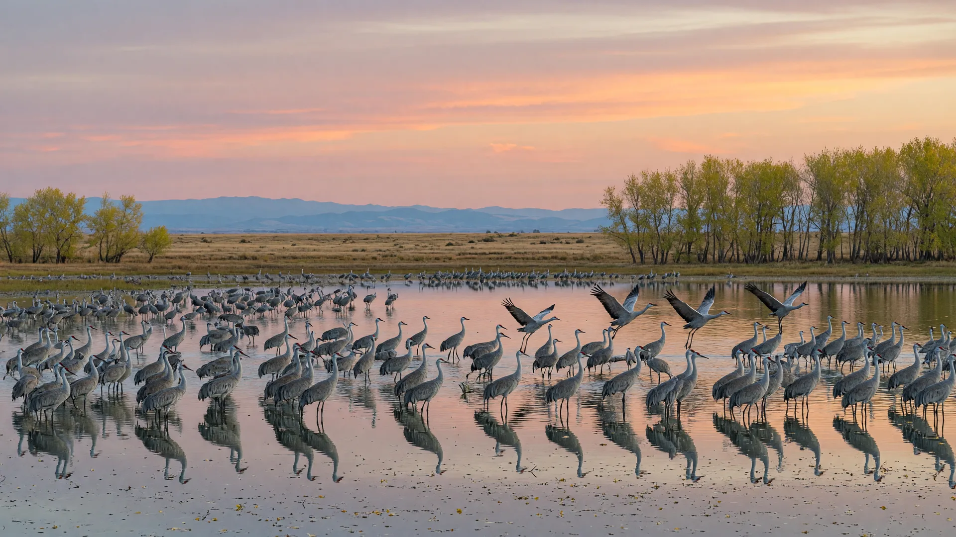
For parks near Merced this week, the pick is Merced National Wildlife Refuge, a free U.S. Fish and Wildlife Service refuge about 12 miles southwest of downtown Merced. It suits October perfectly: the first sandhill cranes of fall are arriving now, the cottonwoods around the ponds are turning gold, and cool mornings make the 5-mile auto tour route and two easy walking loops comfortable at any hour the refuge is open.
Merced National Wildlife Refuge sits on the west side of Merced County at 7430 West Sandy Mush Road, Merced, CA 95341, part of the San Luis National Wildlife Refuge Complex. The main entrance is off Sandy Mush Road, about 8 miles west of Highway 59, and the drive from downtown Merced takes roughly 20 minutes. The refuge protects seasonal wetlands, grasslands, and vernal pools that support one of the largest concentrations of wintering waterfowl in California, and it is open daily from half an hour before sunrise to half an hour after sunset with no entrance fee. If you missed the wider nature calendar, this week's Seasonal Nature Report covers the cranes, early fall color, and the Sierra first-snow watch.
Parks Near Merced: This Week's Pick
The headline act in October is the sandhill cranes. The refuge hosts the largest wintering concentration of lesser sandhill cranes on the Pacific Flyway, with more than 15,000 typically present by Thanksgiving; the first arrivals show up in mid-September, and numbers build through the fall. At dawn and dusk, flocks lift off and return to the ponds in waves, and the cottonwoods and willows around the water turn gold against the morning light. Because the auto tour is drivable, the refuge works for every age and ability, from a quick sunrise loop in the car to a full morning on the walking trails.
Trail and Auto Tour Details
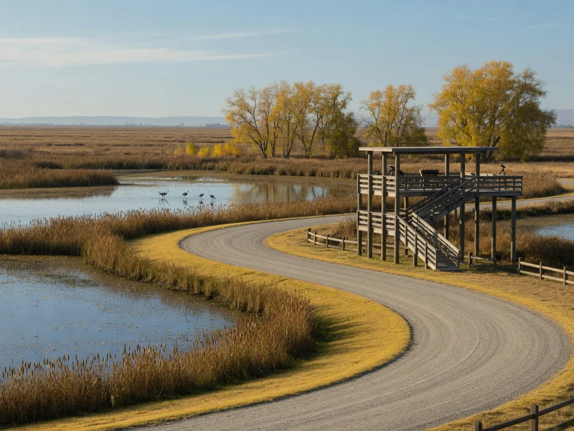
Merced National Wildlife Refuge is more of a drive-and-walk refuge than a hiking destination, and that is part of its appeal. The 5-mile auto tour loop is a one-way route on all-weather compacted gravel, open year-round, with two elevated wildlife observation platforms, one at the entrance parking lot. For walking, the refuge has four nature trails; the two easiest to plan around are the Cottonwood Trail, an easy, flat loop of about 1 mile on the north side of Sandy Mush Road, and the Bittern Marsh Trail, a gravel loop of about 1 mile that starts from the auto tour route and includes a spur to a cottonwood picnic area. The Fish and Wildlife Service does not publish difficulty ratings; third-party trail sites rate both loops easy. Trails are open to leashed dogs, and there is no fee for any of it.
Amenities
Facilities are intentionally minimal, so plan ahead. At the entrance you will find an information kiosk with brochures and a covered picnic shelter with picnic tables. More picnic tables sit along the Bittern Marsh Trail, and pit toilets are available near the entrance. There is no visitor center, no drinking water, and no food for sale, so bring water, snacks, and anything else you need for the day. Dogs are allowed on the nature trails on a leash and under control at all times.
Parking and Getting There
Parking is free at the entrance lot off Sandy Mush Road, where the kiosk, picnic shelter, and one of the observation platforms are located. The Cottonwood Trail starts across Sandy Mush Road from the entrance, and the Bittern Marsh Trail begins from the auto tour route, so most visitors park at the entrance lot and drive the loop. From Merced, take Highway 59 south and head about 8 miles west on Sandy Mush Road; from Interstate 5 near Los Banos, follow the signed route through the grasslands to Sandy Mush Road. The refuge is an easy day trip from anywhere in Merced County, including Winton, Livingston, and Atwater. During waterfowl season, parts of the refuge are used for hunting on Wednesdays and Saturdays; the auto tour and trails stay open on those days, but expect more activity.
Best Time to Go
For fall, early morning is the classic window: the air is cool, the light is golden, and the cranes are most active as they leave the roost. Late afternoon through sunset is the other peak, when flocks return to the ponds. The refuge opens half an hour before sunrise and closes half an hour after sunset, so the whole day is usable; midday in October is pleasant, but the bird activity is quieter. Weekday mornings tend to be the calmest visits, and the refuge is open every day of the year. For water-side alternatives, this week's Lake & Water Activities guide covers Lake Yosemite, Lake McSwain, Lake McClure, and the Merced River at Briceburg.
Map and Official Links
The official U.S. Fish and Wildlife Service page for Merced National Wildlife Refuge posts current hours, trail details, and alerts. For turn-by-turn directions, use the Google Maps listing for the refuge. Both open in a new tab, and the refuge phone line is (209) 826-3508.
Past Picks
This is the first edition of the Trail or Park of the Week series. Each week's pick will be archived here, so you can build a year-round list of parks and trails across Merced County and the nearby Sierra foothills. These public lands are open to everyone, and Monica offers equal service to all.
Enjoy the outdoors, Merced. And when you are ready to talk about your home, Monica is here: schedule a free consultation with Monica Franks, The Seller's Agent, and learn more about Monica's approach on her about page.
Frequently Asked Questions About Parks and Trails Near Merced
What are the best parks and trails near Merced?
Merced National Wildlife Refuge is the top pick for wildlife and easy walking, with a free 5-mile auto tour and two 1-mile walking loops. For water, Lake Yosemite near Merced has a swim beach and kayak rentals, and Lake McSwain offers calm no-wake paddling; both are covered in the weekly Lake & Water Activities guide. For foothill hiking, the Merced River at Briceburg east of Mariposa has free day use and the Merced River Trail.
Is Merced National Wildlife Refuge free?
Yes. There is no entrance fee and no permit required for the auto tour route or the nature trails. Parking is free, and the refuge is open daily from half an hour before sunrise to half an hour after sunset.
When do sandhill cranes arrive at Merced National Wildlife Refuge?
The first cranes arrive in mid-September, numbers build through the fall, and the refuge typically holds more than 15,000 by Thanksgiving. They are abundant from September through March, with the peak from late September through February.
Are dogs allowed at Merced National Wildlife Refuge?
Yes, on the nature trails, on a leash and under control at all times. Dogs are not allowed to roam at large on the refuge.
How long is the auto tour at Merced National Wildlife Refuge?
The auto tour is a 5-mile one-way loop on all-weather compacted gravel, open year-round, with two elevated observation platforms. It takes about 30 to 45 minutes at a slow wildlife-watching pace.
Are there restrooms and picnic areas at Merced National Wildlife Refuge?
Facilities are minimal: a covered picnic shelter with picnic tables near the entrance, more picnic tables along the Bittern Marsh Trail, and pit toilets. There is no visitor center and no drinking water, so bring your own.

The Seller's Agent. Monica combines deep Merced County market knowledge with a polished, confident approach that gets results for home sellers across the Central Valley. Serving Merced, Atwater, McSwain, Livingston, Turlock, Winton, Chowchilla, Catheys Valley, and Mariposa.
The Seller's Agent. Who You Choose Matters.
Enjoy the outdoors, Merced. And when you are ready to talk about your home, Monica offers a free, no-obligation consultation to discuss your goals and what your property could achieve in today's market. Call (209) 345-3836 or use the form below.
Add Monica Franks as a Preferred Source on Google to see more of my content in AI Mode and AI Overviews.
Add as Preferred Source